2. THEMATIC MAPS


(1074x780)
  2.1. Bathymetry and topography of Kongsfjorden

(2x 1000x1038)
  2.2. Schematic layout of sea currents in Kongsfjorden

(2x 683x620)
  2.3. Summer layout of surface salinity and temperature in Kongsfjorden

(817x600)
  2.4. Surface sediments distribution in Kongsfjorden

(800x670)
  2.5. Schematic layout of benthic macrofauna assemblages in Kongsfjorden

(800x576)
  2.6. Meiobenthos density in Kongsfjorden

(1604x900)
  2.7. Fast ice cover map in Kongsfjorden

 
  2.8. Water masses in Kongsfjorden during summer

(1600x1766)
  2.9. Map of Hornsund area

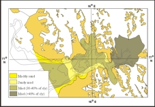
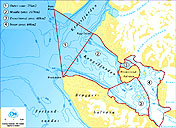
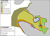
  2.10. Surface sediments distribution in Hornsund

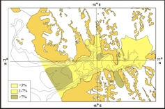
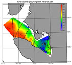
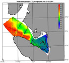
  2.11. Organic mater content in the surface sediments of Hornsund mmmmm